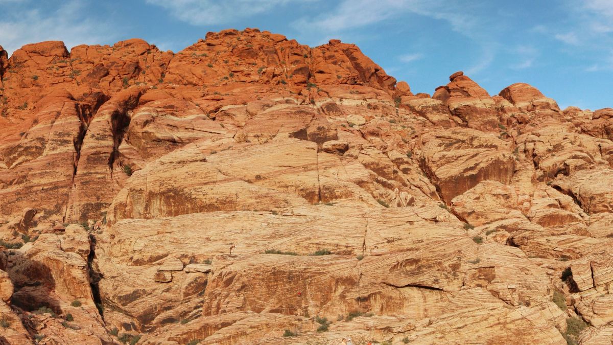
Red Rock Canyon National Conservation Area, near Las Vegas, Nevada, United States
Red Rock Canyon Nevada
Sandstone walls, a -way loop road and Mojave Desert terrain west of the Las Vegas Strip
- 13 miles (21 km)One-way scenic loop road
- 17 milesDistance west of the Las Vegas Strip
- Approximately 30 minutesDriving time from the Strip
Overview
Clark County, Nevada, United States, is the location of Red Rock Canyon National Conservation Area. It is one of the easternmost parts of the Mojave Desert. Management of the area rests with the Bureau of Land Management, within its National Landscape Conservation System.
The conservation area lies 17 miles west of the Las Vegas Strip, and driving from the Strip takes approximately 30 minutes. Most hotels in the region are located on the Strip.
A loop road 13 miles (21 km) long, open to traffic in one direction only, gives vehicle access to many features of the area.
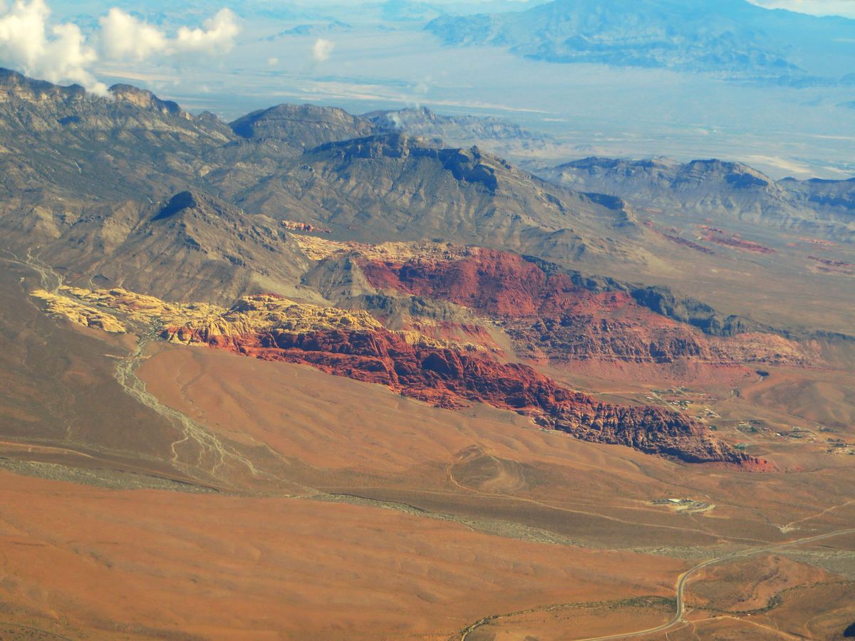
Why visit
- Thrust-fault sandstone walls climb to as much as 3,000 feet (910 m).
- The conservation area's highest point is La Madre Mountain, at 8,154 feet (2,485 m).
- Hikes can last anywhere from a few minutes to a full day.
- Plant species known in the conservation area number about 600.
- Desert tortoises have protected habitat in the conservation area.
- Familiar sights include wild burros, rabbits and ground squirrels, with desert bighorn sheep occasionally seen at higher elevations.
- Fault movement drove older gray rock over younger red rock, creating the varicolored landscape.
Tours and organised trips
Tour buses and commercial tours may be available from Las Vegas hotels, while public transportation does not reach the canyon. Timed-entry reservations for commercial buses, motorcoaches and vans go through Recreation.gov. A Special Recreation Permit from the BLM is needed for paid guiding, large groups and weddings. Listings of bookable tours and activities follow.
Tours and activities
The Scenic Drive and roadside stops
A run along the one-way Scenic Drive, with no stops, lasts about 45 minutes. Driving the wrong way is illegal and will be ticketed. to 12 p.m.
Overlook and picnic area
Stopping at the Red Rock Overlook on SR 159 needs no reservation or fee, but parking may be limited. The Red Spring Picnic Area has a fully accessible boardwalk 0.6 miles (1 km) long. No fee or reservation is needed to park there, but parking is likely to fill up on busy days.
Reservations, fees and opening hours
A timed entry reservation is needed for the Scenic Drive between October 1 and May 31, covering entry from 8 a.m. to 5 p.m. Booking is on Recreation.gov or by phone at (877) 444-6777. Campsite reservations and the group picnic area can also be booked by phone at 877-444-6777. Commercial buses and vans pay an extra $5 per person, excluding the driver, on arrival.
Daily entry fees
| Type of entry | Fee per day |
|---|---|
| Private vehicle | $20 |
| Motorcycle | $10 |
| Bicycle | $8 |
| Pedestrian | $5 |
Visitor center, water and phone signal
The visitor center is open 8:00 am to 4:30 pm daily, and a small drink stand sells bottled beverages inside during these hours. No potable water is available on the Scenic Drive, and the visitor center is the stated place to fill up.
The Keystone Thrust and the Aztec Sandstone
The Keystone Thrust Fault developed around 66 million years ago, during the Laramide orogeny. The thrust is exposed for 13 miles (21 km) along the Red Rock escarpment. Movement along the fault placed older gray rock over younger red rock.
The Aztec Sandstone is an Early Jurassic formation of mostly wind-blown sand. It is primarily eolian sand and is exposed in the Mojave Desert of Arizona, California and Nevada.
How protection of the land developed
Protection of Red Rock Canyon came in stages, beginning with a refuge designation in 1936 and continuing through acts of Congress in 1998 and 2014. The table lists each step.
| Year | Event |
|---|---|
| 1936 | Congress made Red Rock Canyon part of the Desert Game Refuge, today called the Desert National Wildlife Refuge. |
| 1964 | The BLM took 10,000 acres at Red Rock out of reach of mining and other development. |
| 1967 | The BLM set aside 62,000 acres as Red Rock Canyon Recreation Lands, the first formal designation at Red Rock. |
| 1990 | A change in legislation turned the Red Rock Recreation Lands into a National Conservation Area. |
| 1994 | A second public law expanded the national conservation area to 196,000 acres. |
| 1998 and 2014 | The Southern Nevada Public Land Management Act of 1998 brought in a smaller area, and the National Defense Authorization Act of 2014 brought in more than a thousand acres. |
Cycling, riding and other rules
The scenic loop road is popular for bicycle touring. It starts with a moderate climb and is then mostly downhill or flat.
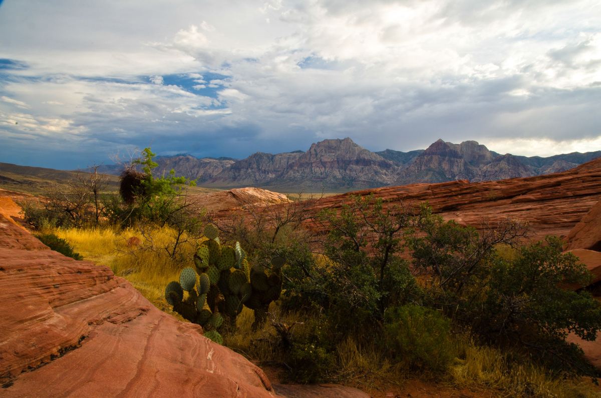
When to go
Summer temperatures at Red Rock Canyon can routinely exceed 105 °F (41 °C).
Seasons in detail
Heat, cold and storms
Summer storms
Strong thunderstorms are possible in the Mojave Desert in the late summer months and can cause flash flooding.
Winter, rain and snow
Overnight minimum temperatures in Las Vegas average around 40 °F (4.4 °C) in December and January, and the city records freezing temperatures on an average of 10 nights per winter. The mountains around the Las Vegas Valley accumulate snow every winter, while significant snow in the city itself is rare.
Las Vegas averages 4.2 inches (110 mm) of rainfall per year, and February is its wettest month, averaging only four days of measurable rain.
How to get there
No public transportation extends as far as Red Rock Canyon, and ride share users can only do activities at the visitor center and the hiking trails that start there.
Routes and transport
Fuel, food and supplies
The closest restaurants, supermarkets, gas stations and banks are at Charleston Boulevard and Desert Foothills Drive, 4.5 miles northeast of the visitor center.
Where to stay
The conservation area is 17 miles west of the Las Vegas Strip, and most hotels are located on the Strip, about 30 minutes away. Red Rock Canyon Campground is at 3293 Moenkopi Rd., Las Vegas, NV 89161, and a night there costs $25 per individual site or $80 per group site.
Lodging and camping
Camping at Red Rock Canyon Campground
| Site type | Number of sites | Capacity per site |
|---|---|---|
| Individual standard | 53 | Up to 10 people and 2 vehicles |
| Large group | 7 | Up to 50 people and 8 vehicles |
Camping costs $25 per individual site per night and $80 per group site per night. The campground can only be booked through Recreation.gov, and it is available from September 1 to May 31.
Campfires and charcoal barbecues are prohibited in Red Rock Campground until fire restrictions are lifted, usually in late September or early October.
Backcountry and dispersed camping
Dispersed camping off Lovell Canyon Road stays open through the June 1 to August 31 closure of the campground. A backcountry camping permit is required and can be obtained by phone at 702-515-5050.
Guides
Guides to Red Rock Canyon
Frequently asked questions
How far is Red Rock Canyon from the Las Vegas Strip?
The conservation area is 17 miles west of the Las Vegas Strip, and driving from the Strip to Red Rock Canyon takes approximately 30 minutes.
When do Scenic Drive reservations apply?
A timed entry reservation is needed for the Scenic Drive between October 1 and May 31, covering entry from 8 a.m. to 5 p.m. Booking is on Recreation.gov or by phone at (877) 444-6777.
How much does entry cost?
Daily entry fees are $20 per private vehicle, $10 per motorcycle, $8 per bicycle and $5 per pedestrian. Commercial buses and vans pay an extra $5 per person, excluding the driver, on arrival.
Can visitors get to Red Rock Canyon by public bus?
Public transportation stops short of Red Rock Canyon. Tour buses and commercial tours may run from visitors' hotels, and ride share users can only do activities at the visitor center and the hiking trails that start there.
When is Red Rock Canyon Campground open?
The campground is available from September 1 to May 31 and can only be booked through Recreation.gov. Between June 1 and August 31 it is closed, though dispersed camping off Lovell Canyon Road stays open all year while spots last.
Where can water be filled for the Scenic Drive?
No potable water is available on the Scenic Drive. The visitor center, open 8:00 am to 4:30 pm daily, is the stated place to fill up.
Which months are the hottest in Las Vegas?
June through September are the extremely hot summer months in Las Vegas. July is the hottest month, with an average daytime high of 104.5 °F (40.3 °C).
How long does the loop road take to drive?
The loop road runs 13 miles (21 km) one way and takes about 45 minutes to drive without stopping.
Sources
- Red Rock Canyon National Conservation Area
- Red Rock Canyon National Conservation Area - Nevada | Bureau of Land Management
- Red Rock Canyon National Conservation Area | Bureau of Land Management
- Planning Your Visit | Bureau of Land Management
- Aztec Sandstone
- Red Rock Celebrates 25 Years as a National Conservation Area | Bureau of Land Management
- Las Vegas
- Mojave Desert
- Red Rock Canyon Campground - Nevada | Bureau of Land Management
- Red Rock Canyon Campground Reopens August 30 | Bureau of Land Management
- Red Rock Canyon Campground to Reopen Today | Bureau of Land Management
- Red Rock Canyon Campground Reopens Friday, Sept. 2, 2016 | Bureau of Land Management